Maps and GPX files
Use of maps and GPX files for hiking and hillwalking in Scotland.
Different types of maps, suggested compass and use of GPX files for hiking and hillwalking in Scotland explained !
There's a fair selection of maps for navigating on the Scottish mountains, but which is the more appropriate one for your hillwalking day ?
Here I try to compare different maps and select the best one for your hike.
The UK's Ordnance Survey produces several types of maps covering the whole of the country. For outdoor enthusiasts, the OS Landranger and OS Explorer maps are the two main types, both of which are available on paper and for electronic devices. You can also have a custom Landranger or Explorer map made, centred on a specific point.
Harvey Maps are an independent company based in Doune, Perthshire. "Made by walkers, for walkers", Harvey maps are designed for a specific purpose, with the outdoor leisure maps available in 3 different scales. Harvey Maps don't cover the whole of the UK.
Other Maps worth investigating are OpenCycle maps, Google maps and aerial maps. Apart from being mostly free, there are some other advantages of these.
Your map choice will be determined by a number of factors, including terrain, distance you expect to cover and speed you'll be moving at, the scale on your compass, the location reference system and much more.
The compass you should go for is affected the type of map that you use.
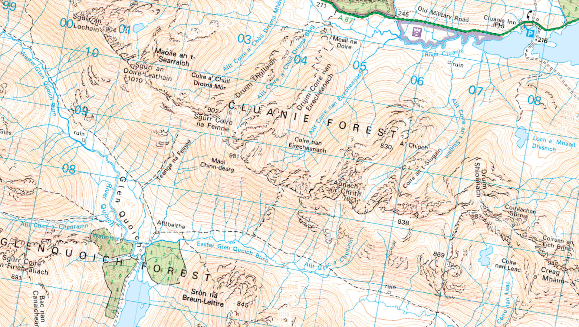
 The OS Landranger has a scale of 1:50000, allowing for a large area to be covered in one map.
The mapping is clear with most of the features outdoor enthusiasts are interested in easily distinguished.
The OS Landranger has a scale of 1:50000, allowing for a large area to be covered in one map.
The mapping is clear with most of the features outdoor enthusiasts are interested in easily distinguished.
Height level is not shown with a colour index, therefore sometimes you may need to look carefully at the map to see the aspect of slope on mountains.
The standard map is printed on paper, which means you'll need to put it into a map case on wet days. There is a waterproof version available, called 'Active' - this is a laminated paper map which is rather bulky and difficult to fold to the area you'll be hiking in. Depending on the area you'll be walking over, you may need to use 2 or even 3 maps for the one area (the Ossian Munros is a good example of this).
With the current series of Landranger maps you get a free download of the map to use with electronic devices - ideal if you use a smartphone for navigation back-up. The OS produces its own app and software - OS Maps, and licenses out the maps, which makes using the Landranger series on laptop, tablet or phone a doddle.
Summary
With a scale of 1:50000 and with contour interval of 10m (index interval of 50m), the OS Landranger is a good default choice for navigating on Scotlands mountains. It is not suitable for Skye or other areas with complex rocky terrain.
Pros
Cons
 At twice the scale of the OS Landranger maps, the OS Explorer maps have a lot more detail on them.
However, this isn't necessarily a good thing, expecially for vast open areas in the Scottish Highlands !
Sometimes with so much going onto the map, it can become diffcult to identify key features, particularly steep ground and crags.
And you'll need more Explorer maps to cover the area of a Landranger map.
At twice the scale of the OS Landranger maps, the OS Explorer maps have a lot more detail on them.
However, this isn't necessarily a good thing, expecially for vast open areas in the Scottish Highlands !
Sometimes with so much going onto the map, it can become diffcult to identify key features, particularly steep ground and crags.
And you'll need more Explorer maps to cover the area of a Landranger map.
But for areas with right-of-way paths through farming or forestry, where it is important to identify fence-lines, walls and fire-breaks then the Explorer maps are preferred over the Landranger equvalent.
Summary
The OS Explorer maps have a scale of 1:25000. With a superfluous amount of detail on these maps, these would not be my first choice for navigating on Scotland's mountains. They are not suitable for Skye or other areas with complex rocky terrain as there is too much detail which makes identifying specific features very difficult. OS Explorer maps are more suitable for areas with human activity where walls, fences and paths need to be identified, eg Lake District.
Pros
Cons
 The Harvey 'Britsh Mountain Map' series is put together in conjunction with the BMC and the MCofS.
The maps are laid out with outdoor enthusiasts in mind, therefore such features as Munro summits, scree, crags and climbing venues all being distinguished clearly.
The Harvey 'Britsh Mountain Map' series is put together in conjunction with the BMC and the MCofS.
The maps are laid out with outdoor enthusiasts in mind, therefore such features as Munro summits, scree, crags and climbing venues all being distinguished clearly.
With a scale of 1:40000, you'll need a compass with an suitable romer, but at this scale the map gives a fine compromise between amount of detail and area coverage. The areas shown on each map are thoughtfully chosen and where there is a landmass that extends from the bulk of the map, it will most likely be shown on the reverse.
A height colour index helps quickly identifying mountains quickly and a contour interval of 15m ensures contours don't 'disappear' as is possible on the OS Landranger maps.
These maps are printed on ploymer and are 100% waterproof, making them easy to fold to the desired area of hiking. On the back of the maps, there is a trove of useful information including Access Rights, avalanche information, first-aid basics, geology of the area, how to use a compass and much more.
Summary
The Harvey Mountain maps are simply superb ! The scale of 1:40000 is a fine compromise, with contours set at 15m (index contour at 75m). The maps are designed specifically for outdoor enthusiasts, with an appropriate level of detail laid out very clearly. My first choice of map, though not all areas in UK covered by this series.
Pros
Cons
 The Harvey 'Superwalker Map' series has been the company's core outdoor map for many years.
The maps are available for specific hiking areas in the country and are very clear with all footpaths, right-of-ways, crags and other key features easily distinguised.
The Harvey 'Superwalker Map' series has been the company's core outdoor map for many years.
The maps are available for specific hiking areas in the country and are very clear with all footpaths, right-of-ways, crags and other key features easily distinguised.
Similar to the 'Mountain Maps', contour colours vary depending on type of terrain, and different types of land-use use different block colours. However unlike the 'Mountain Maps', there isn't a colour height index.
With a scale of 1:25000, the clarity enables people who would normally wear glasses, to read the map without fumbling around in pockets for their specs. The maps are also very accurate, often appearing more up-to-date than the OS equvalent and are laid out to reflect the layout of the land, rather than just a square block of the countryside.
Like the 'Mountain maps', these maps are printed on ploymer and are 100% waterproof, making them easy to fold to the desired area of hiking.
Summary
Possibly a too-large scale for most of the Scottish Highlands, however if you normally wear glasses, then this is the map series for you when you're out on the hills. This is the map needed for Skye and other intricate rocky areas !
Pros
Cons
 Recently introduced, the Harvey 'Ultramap' series has been designed for runners and those who want to cover large areas quickly.
They are bascially 'Superwalker' maps but at 1:40000 scale, so you get all the benefits of the 'Superwalker', in a smaller sized and lighter map.
Recently introduced, the Harvey 'Ultramap' series has been designed for runners and those who want to cover large areas quickly.
They are bascially 'Superwalker' maps but at 1:40000 scale, so you get all the benefits of the 'Superwalker', in a smaller sized and lighter map.
The mapped area is printed over both sides of the sheet (with an overlap) which is designed to be easily folded over.
Like the other Harvey maps, these maps are printed on polymer and are 100% waterproof.
Summary
A good map if you cover large areas quickly and weight is important to you !
Pros
Cons
 The Harvey 'Summit' series has been designed to provide more detail for a few selective mountainous areas.
At a scale of 1:12500, they are twice the scale of 'Superwalker' maps.
The Harvey 'Summit' series has been designed to provide more detail for a few selective mountainous areas.
At a scale of 1:12500, they are twice the scale of 'Superwalker' maps.
The maps specifically show significant crags, highlighting areas of danger. They are designed to be used in conjuction with other maps for fine navigation in bad conditions such as snow, mist and darkness.
Like the other Harvey maps, these maps are printed on polymer and are 100% waterproof.
Summary
Very clear maps for hiking in deterioating conditions in known 'danger areas'.
Pros
Cons
Open Cycle maps
The Open Cycle maps (see www.opencyclemap.org) which are available online are great for planning days. The maps are fairly clear with a good level of detail. However crags are not shown at all ! The maps are updated by an online community, so paths and tracks tend to be up-to-date. Not great for printing as with all the colour and shading they'll quickly use up your printer ink and a scale grid-line can't be overlaid.
Google maps and Streetview
Not appropriate for navigating on the hills, but possibly the best way to share directions to the start of a hike ! Google Maps (see www.google.co.uk/maps) has different overlays including 'terrain' map, aerial imagery and 'streetview'. I've frequently used the aerial imagery to plan days on the hills, particularly useful for finding hidden bridges of streams.
 As a compass is an essential bit of hillwalking kit, you'll want to invest in a decent compass !
Don't go for the cheapest compass you can find, buy something from a brand like Silva or Sunnto.
As a compass is an essential bit of hillwalking kit, you'll want to invest in a decent compass !
Don't go for the cheapest compass you can find, buy something from a brand like Silva or Sunnto.
Some things to check for when buying a compass :
 A GPX file, is a series of points that can be used to describe objects or routes on land.
GPX is an abbreviation of GPS Exchange Format and these files are in an open and a standard XML format which can therefore be used by various applications.
A GPX file, is a series of points that can be used to describe objects or routes on land.
GPX is an abbreviation of GPS Exchange Format and these files are in an open and a standard XML format which can therefore be used by various applications.
The GPX files that can be downloaded from this website contain the essential information to create routes using a series of route-point co-ordinates. In the main, the routes were recorded by a GPS device, then edited to remove surplus information and correct any anomalies.
To download a GPX file on a mobile device :
To download a GPX file onto Windows device :
Here I try to compare different maps and select the best one for your hike.
The UK's Ordnance Survey produces several types of maps covering the whole of the country. For outdoor enthusiasts, the OS Landranger and OS Explorer maps are the two main types, both of which are available on paper and for electronic devices. You can also have a custom Landranger or Explorer map made, centred on a specific point.
Harvey Maps are an independent company based in Doune, Perthshire. "Made by walkers, for walkers", Harvey maps are designed for a specific purpose, with the outdoor leisure maps available in 3 different scales. Harvey Maps don't cover the whole of the UK.
Other Maps worth investigating are OpenCycle maps, Google maps and aerial maps. Apart from being mostly free, there are some other advantages of these.
Your map choice will be determined by a number of factors, including terrain, distance you expect to cover and speed you'll be moving at, the scale on your compass, the location reference system and much more.
The compass you should go for is affected the type of map that you use.
Ordnance Survey Landranger
The OS Landranger has a scale of 1:50000, allowing for a large area to be covered in one map.
The mapping is clear with most of the features outdoor enthusiasts are interested in easily distinguished.
Height level is not shown with a colour index, therefore sometimes you may need to look carefully at the map to see the aspect of slope on mountains.
The standard map is printed on paper, which means you'll need to put it into a map case on wet days. There is a waterproof version available, called 'Active' - this is a laminated paper map which is rather bulky and difficult to fold to the area you'll be hiking in. Depending on the area you'll be walking over, you may need to use 2 or even 3 maps for the one area (the Ossian Munros is a good example of this).
With the current series of Landranger maps you get a free download of the map to use with electronic devices - ideal if you use a smartphone for navigation back-up. The OS produces its own app and software - OS Maps, and licenses out the maps, which makes using the Landranger series on laptop, tablet or phone a doddle.
Summary
With a scale of 1:50000 and with contour interval of 10m (index interval of 50m), the OS Landranger is a good default choice for navigating on Scotlands mountains. It is not suitable for Skye or other areas with complex rocky terrain.
Pros
- Not over-cluttered giving a great overall picture of landscape
- Significant paths shown
- Good value for money
- Comes with a free download for electronic device
Cons
- Fences, walls and forest fire-breaks are not shown
- Small crags, scree and small burns often not shown
- Contour lines can 'disappear'
- No height color legend
- A specific hike might need 2 or more Landranger maps
- Paper version is not waterproof, 'Active' version is bulky
- Doesn't seem to be updated with corrections as often as Explorer map
Ordnance Survey Explorer
At twice the scale of the OS Landranger maps, the OS Explorer maps have a lot more detail on them.
However, this isn't necessarily a good thing, expecially for vast open areas in the Scottish Highlands !
Sometimes with so much going onto the map, it can become diffcult to identify key features, particularly steep ground and crags.
And you'll need more Explorer maps to cover the area of a Landranger map.
But for areas with right-of-way paths through farming or forestry, where it is important to identify fence-lines, walls and fire-breaks then the Explorer maps are preferred over the Landranger equvalent.
Summary
The OS Explorer maps have a scale of 1:25000. With a superfluous amount of detail on these maps, these would not be my first choice for navigating on Scotland's mountains. They are not suitable for Skye or other areas with complex rocky terrain as there is too much detail which makes identifying specific features very difficult. OS Explorer maps are more suitable for areas with human activity where walls, fences and paths need to be identified, eg Lake District.
Pros
- Fences, walls and forest fire-breaks are shown
- Significant and most faint paths shown
- Large amount of detail
- Comes with a free download for electronic device
Cons
- Can be over-cluttered making features difficult to identify
- Map will need to be frequently re-folded if covering a large area
- No height color legend
- More expensive than OS Landranger
- Paper version is not waterproof, 'Active' version is bulky
Harvey Mountain Map
The Harvey 'Britsh Mountain Map' series is put together in conjunction with the BMC and the MCofS.
The maps are laid out with outdoor enthusiasts in mind, therefore such features as Munro summits, scree, crags and climbing venues all being distinguished clearly.
With a scale of 1:40000, you'll need a compass with an suitable romer, but at this scale the map gives a fine compromise between amount of detail and area coverage. The areas shown on each map are thoughtfully chosen and where there is a landmass that extends from the bulk of the map, it will most likely be shown on the reverse.
A height colour index helps quickly identifying mountains quickly and a contour interval of 15m ensures contours don't 'disappear' as is possible on the OS Landranger maps.
These maps are printed on ploymer and are 100% waterproof, making them easy to fold to the desired area of hiking. On the back of the maps, there is a trove of useful information including Access Rights, avalanche information, first-aid basics, geology of the area, how to use a compass and much more.
Summary
The Harvey Mountain maps are simply superb ! The scale of 1:40000 is a fine compromise, with contours set at 15m (index contour at 75m). The maps are designed specifically for outdoor enthusiasts, with an appropriate level of detail laid out very clearly. My first choice of map, though not all areas in UK covered by this series.
Pros
- Very clear and well designed map
- Level of detail just right for hiking
- Crags shown clearly with bold black line
- Forest fire-breaks and significant walls and fence-lines shown
- Colour height index and different contour line colour to show type of terrain
- Vast area covered, designed around hiking trips
- Munros, Corbetts and Grahams identified
- Lots of other useful information on reverse of map
- Waterproof and foldable
Cons
- At 1:40000 you need to check your compass has the appropriate scale
- The 15m contour takes some getting used to
- Not all of UK mountains and hills covered
- About twice the price of a OS Landranger map, but worth the extra outlay
Harvey Superwalker XT25
The Harvey 'Superwalker Map' series has been the company's core outdoor map for many years.
The maps are available for specific hiking areas in the country and are very clear with all footpaths, right-of-ways, crags and other key features easily distinguised.
Similar to the 'Mountain Maps', contour colours vary depending on type of terrain, and different types of land-use use different block colours. However unlike the 'Mountain Maps', there isn't a colour height index.
With a scale of 1:25000, the clarity enables people who would normally wear glasses, to read the map without fumbling around in pockets for their specs. The maps are also very accurate, often appearing more up-to-date than the OS equvalent and are laid out to reflect the layout of the land, rather than just a square block of the countryside.
Like the 'Mountain maps', these maps are printed on ploymer and are 100% waterproof, making them easy to fold to the desired area of hiking.
Summary
Possibly a too-large scale for most of the Scottish Highlands, however if you normally wear glasses, then this is the map series for you when you're out on the hills. This is the map needed for Skye and other intricate rocky areas !
Pros
- Very clear with good level of detail
- Crags shown clearly with bold black line
- Forest fire-breaks and significant walls and fence-lines shown
- Varying contour line colour to distinguish terrain type
- Varying block colours to show different land-uses
- Munros, Corbetts and Grahams identified
- Best map for those who wear glasses
- Waterproof and foldable
Cons
- The 15m contour takes some getting used to
- Not all of UK mountains and hiking areas covered
- More expensive than OS maps
Harvey Ultramap XT40
Recently introduced, the Harvey 'Ultramap' series has been designed for runners and those who want to cover large areas quickly.
They are bascially 'Superwalker' maps but at 1:40000 scale, so you get all the benefits of the 'Superwalker', in a smaller sized and lighter map.
The mapped area is printed over both sides of the sheet (with an overlap) which is designed to be easily folded over.
Like the other Harvey maps, these maps are printed on polymer and are 100% waterproof.
Summary
A good map if you cover large areas quickly and weight is important to you !
Pros
- Clear mapping with good level of detail
- Crags, forest fire-breaks, walls and fence-lines shown clearly
- Varying contour line colour to distinguish terrain type
- Varying block colours to show different land-uses
- Small, lightweight, waterproof and foldable
Cons
- The 15m contour takes some getting used to
- Not all of UK mountains and hiking areas covered
- Quite pricy for amount of coverage
Harvey Summit maps
The Harvey 'Summit' series has been designed to provide more detail for a few selective mountainous areas.
At a scale of 1:12500, they are twice the scale of 'Superwalker' maps.
The maps specifically show significant crags, highlighting areas of danger. They are designed to be used in conjuction with other maps for fine navigation in bad conditions such as snow, mist and darkness.
Like the other Harvey maps, these maps are printed on polymer and are 100% waterproof.
Summary
Very clear maps for hiking in deterioating conditions in known 'danger areas'.
Pros
- Very clear mapping at large scale
- Specifically designed to show dangerous areas like crags, cliffs and changes of ridge directions
- Varying contour line colour to distinguish terrain type
- Small, lightweight and waterproof
Cons
- Only available for specific known 'hotspots' !
Other maps
There are some other maps available online worth checking out before heading onto the hills !Open Cycle maps
The Open Cycle maps (see www.opencyclemap.org) which are available online are great for planning days. The maps are fairly clear with a good level of detail. However crags are not shown at all ! The maps are updated by an online community, so paths and tracks tend to be up-to-date. Not great for printing as with all the colour and shading they'll quickly use up your printer ink and a scale grid-line can't be overlaid.
Google maps and Streetview
Not appropriate for navigating on the hills, but possibly the best way to share directions to the start of a hike ! Google Maps (see www.google.co.uk/maps) has different overlays including 'terrain' map, aerial imagery and 'streetview'. I've frequently used the aerial imagery to plan days on the hills, particularly useful for finding hidden bridges of streams.
Compass
As a compass is an essential bit of hillwalking kit, you'll want to invest in a decent compass !
Don't go for the cheapest compass you can find, buy something from a brand like Silva or Sunnto.
Some things to check for when buying a compass :
- The baseplate and romer scales match that on the map you're using, typically 1:25000, 1:40000 or 1:50000. If you find the compass has 1:63300, then this is the old 1 inch : 1 mile !
- The scale on the compass housing is in degrees (and not mils)
- There are orienting lines and arrow in the compass housing and these are clear
- Magnifier on baseplate is useful for complex terrain
- A cord with scale is ideal for estimating distances
GPX files
A GPX file, is a series of points that can be used to describe objects or routes on land.
GPX is an abbreviation of GPS Exchange Format and these files are in an open and a standard XML format which can therefore be used by various applications.
The GPX files that can be downloaded from this website contain the essential information to create routes using a series of route-point co-ordinates. In the main, the routes were recorded by a GPS device, then edited to remove surplus information and correct any anomalies.
To download a GPX file on a mobile device :
- On a route page, click 'Maps and GPX downloads »' to expand the box underneath and click the icon next to 'Download GPX file of route'
- A popup should appear 'Do you want to download "filename.gpx"?', click 'Download'
- At the top of the screen, in the URL address box, there should appear a blue circle with a down-arrow - click on this to open a dialog box
- In the box, select the option 'Downloads' and the GPX file should be shown - click on this to open it
- Once the file is open, click the share icon (at bottom-left of the screen)
- Various options are displayed, including a list of apps that can open or share the GPX file - hopefully one is the app you use to navigate with.
- The above procedure is for for an iPhone running Safari, other browsers will differ slightly - eg Google Chrome has less steps.
To download a GPX file onto Windows device :
- On a route page, click 'Maps and GPX downloads »' to expand the box underneath and click the icon next to 'Download GPX file of route'
- The file should download into your default 'Download' folder and be shown at the bottom of your browser
- Clicking on the icon/shortcut will open the GPX file in the default application associated with such files
Alternatively, opening the file location and right-clicking on the file will bring up other actions


