
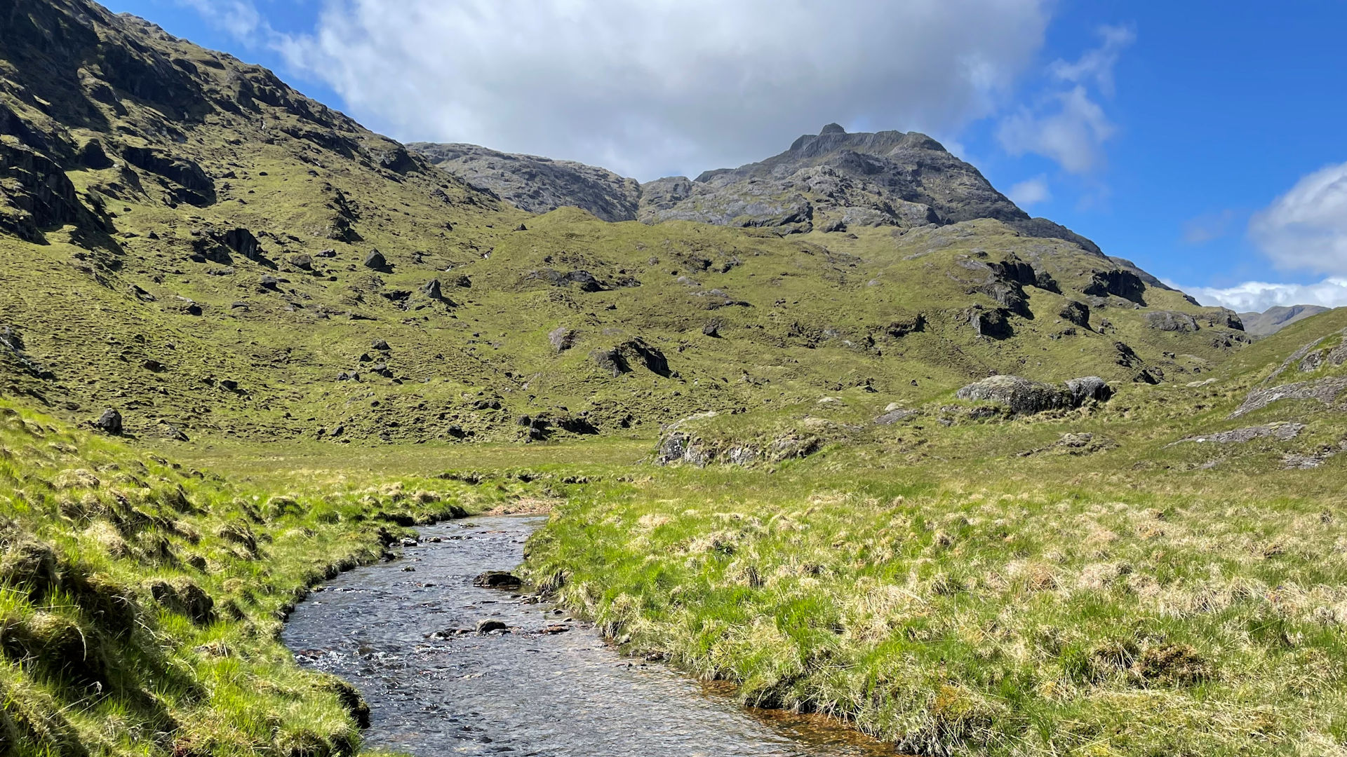
Ben Aden from Loch Cuaich
Hillwalking route from the western shores of Loch Cuaich to Ben Aden
The old road used for the construction of the Loch Cuaich dams eases the effort needed to get to Ben Aden in the remote and wild Rough Bounds of Knoydart. Route from Sourlies is also outlined.
Route outline
| Corbetts | ||||
| Ascent | 1340m (4390ft) | |||
| Distance | 25km (16m) | |||
| Time | 8:30hr | |||
| Start/finish | Caolie Water, Loch Quoich Grid Ref : NG985036 | |||
| Terrain |
| |||
| Nav |
| |||
| Effort |
| |||
| Scenery |
| |||


Ben Aden is a very remote peak, standing in a wild area on the edge of the Rough Bounds of Knoydart. This route is the most direct and for much of the approach, follows the northern shore of Loch Cuaich (Loch Quoich on older maps), on part of which are the remains of an old track. The route reaches the western end of the loch from where an ascent of Ben Aden begins, becoming rough and rocky higher up, testing route-finding skills. This route is not recommended if rivers are in spate !
Show map
Route description
1. Getting to Loch Cuaich (Loch Quoich)

Remains of bridge over Caolie Water
The A87 travels from Invergarry in the Great Glen westwards through Kintail and onwards to Skye. On this road, around 8km west of Invergarry and above the shores of Loch Garry, there is a junction with an unclassified road which is marked heading to Tomdoun and Kinlochourn (sic).
Follow the unclassified road to the north-western end of Loch Cuaich ('Loch Quoich' on older maps) and look for two iron-girders lying over Caolie Water, the remains of an old bridge over the burn that flows into the loch.
Around 200m beyond the old bridge, there is a small parking area cut into the roadside rocky verge, with room for 4 or 5 vehicles.
2. Along the western shores of Loch Quoich

Improving weather on the descent from Sron Lice na Fearna
From the roadside, Caolie Water needs crossed to its southern bank and given the setting and condition of the remains of the old bridge, an upstream crossing would be adviseable. Once over, a faint trod can be followed southwards for a short distance.
Either the shore of Loch Quoich can be followed south-east for 2km before turning westwards, or a shorter ascent up and over Sron Lice na Fearna  can be taken - the ascent costs a climb up 250m, the shore adds a tedious 4km detour. I took the ascent, which was pleasant enough and had the advantage of a gentle grass-covered drop aiming south-west for 2km, which made for swift progress.

Ben Aden and the lower slopes of Sgurr na Ciche
 is reach and needs crossed. If it looks slighty tricky, perhaps try heading a short distance upstream. Once over, a faint path continues and meets with a track
  emerging from the loch - this track was used for the construction of the dams on the loch and is followed for the next 3km or so to the loch's western end.
Ben Aden and the lower slopes of Sgurr na Ciche
3. Ben Aden

Looking up Coire na Cruaiche, ravine on left used
There are two dams at the western end of Loch Quoich, cross the first of these  to its southern side, then take a faint path off right heading above Lochan na Cruadhach.
The faint path crosses a more obvious one  and leads to the foot of Ben Aden. Ahead, a grassy bank aside the Allt Coire na Cruaiche can be seen making a way directly up to the skyline to a point a little to the left of what looks like Ben Aden's summit.
Follow this grassy bank up, there may be a couple of times ( and
and  ) when a burn needs crossed, but otherwise there shouldn't be any difficulties reaching the high ground of Bealach a' Chairn Deirg
  .
.
Above the bealach, cliffs falling south-east block progress - turn northwards and climb up wide gully, bouldery in parts and reach the eastern end of Ben Aden's summit crest. More towers of rock  (marked by spot height of 835m on Harvey maps) hinder passage. Turn north-west around the rock and lose a few metres dropping to a tiny lochan (not marked on maps), after which turn back south-west onto Ben Aden's crest and continue along a wide undulating grassy ridge to the small cairn sitting on the summit
  .
.

On Ben Aden's summit looking ot Sgurr a' Choire-bheithe
On Ben Aden's summit looking ot Sgurr a' Choire-bheithe
4. Return

Looking down Coire na Cruaiche to Loch Quoich
A return will most likely be an about-turn on Ben Aden's summit and a retrace of footsteps.
Hopefully you've noted the key changes in direction along Ben Aden's crest to the top of Bealach a' Chairn Deirg, as, particularly if mist pulls in, navigation will be challenging !
5. Alternative approach from Sourlies Bothy
")
Old bridge over the River Carnach (since replaced)
Lonely Sourlies Bothy stands above a right-of-way footpath that links Loch Arkaig to Loch Nevis from where a hike of 16km up an ascent of 1000m leads to Ben Aden's summit and back. . . .
Having reached Sourlies Bothy, a hike to Ben Aden begins by following the path above Loch Nevis's north shore for just under 1km. Turning northwards, the path meets up with the River Carnach.
Most likely staying on the southern bank of the River Carnach, pick up and follow ATV tracks for around 3km to reach the meetings of the River Carnach and the Allt Achadh a'Ghlinne  , then trace the course of this smaller river upstream. Several narrow gorges with waterfalls can be avoided by keeping to the southern bank of the burn.
At around the 550m contour terrain may become confusing particularly in mist, but climb and reach the lochans on Bealach a' Choire Chruaidh  , just east of the 717m knoll. Over the knoll to gain Bealach a' Chairn Deirg and reach Ben Aden's summit as described above.
Route profile »

Maps and GPX downloads »


|
Download GPX of route |
|
|
Download GPX of Ben Aden from Sourlies |
Information on maps and GPX files is on this page.
The map images above link to items on Amazon. A small commission is earned on any map purchased which helps fund the operating costs of this website.
Weather forecasts »
| Regional | MWIS - Northwest Highlands |
| Peak specific | Mountain Forecast.com Met Office YR.no |
| Seasonal | SAIS - Lochaber Midge forecast |
Alternative and nearby routes »
Sgurr nan Eugallt from Coireshubh | |

|
A straighforward hike up a soggy stalker's path leads onto Sgurr nan Eugallt's north-east ridge, from where a line of old iron fence-posts is followed onto the mountain's summit. Peaks : 1 Corbett
Ascent : 800m (2620ft) Distance : 8km (5m) Time : 3:20hr |
Buidhe Bheinn from Loch Hourn | |

|
A very enjoyable short hike from Kinloch Hourn, following stalkers paths for the most part, leads up Buidhe Bheinn's rugged southern shoulder and onto a short narrow ridge to its summit. Peaks : 1 Corbett
Ascent : 950m (3120ft) Distance : 10km (6m) Time : 4:10hr |
Rough Bounds from Loch Cuaich | |

|
From Loch Cuaich Dam, a hike up Gairich is followed by a challenging route following well defined paths and stalkers tracks along crests to Sgurr na Ciche, the highest peak in the Rough Bounds of Knoydart. Peaks : 5 Munros, 1 Corbett
Ascent : 3240m (10630ft) Distance : 39km (24m) Time : 15:5hr |
Sgurr a' Mhaoraich from Loch Cuaich | |

|
Above the centre of Loch Cuaich, grass-covered slopes rise to meet with the undulating skyline of Sgurr a' Mhaoraich. Stalker's paths, ridges and crests are followed to reach the Sgurr a' Mhaoraich's summit with its fine views, particularly toward the Rough Bounds of Knoydart. Peaks : 1 Munro
Ascent : 835m (2740ft) Distance : 8km (5m) Time : 3:20hr |


