
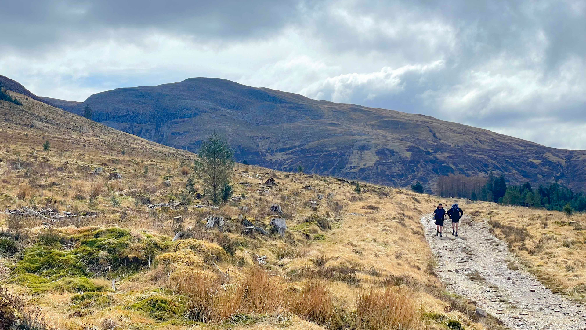
Mam na Gualainn from the West Highland Way
Hillwalking route up Mam na Gualainn from the West Highland Way
South of Fort William, a section of the West Highland Way can be followed through a quiet glen to the foot of Mam na Gualainn, from where a hike up heather clad slopes leads to the hill's grass-covered summit.
Route outline
| Corbetts | ||||
| Ascent | 755m (2470ft) | |||
| Distance | 11km (7m) | |||
| Time | 4:00hr | |||
| Start/finish | By Lochan Lunn Da-Bhra Grid Ref : NN100667 | |||
| Terrain |
| |||
| Nav |
| |||
| Effort |
| |||
| Scenery |
| |||


To the south of Fort William, the well-trodden West Highland Way follows the line of the old military road onwards to Kinlochleven. On the way, as the route turns eastwards, it begins to pass under the north-facing aspects of Mam na Gualainn, from where a pleasant hike up heather clad slopes leads to this hill's grass-covered summit.
Show map
Route description
1. Getting to Lochan Lunn Da-Bhra

West Highland Way by Lochan Lunn Da-Bhra
By the southern end of Fort William's town centre, there is a roundabout by the West End car-park. Taking the exit marked 'Upper Achintore', head uphill through the town's suburbs and out of the 30mph restricted area.
Now on a single-track road with passing places, follow it for 6km to where the road turns sharp right heading for Lochan Lunn Da-Bhra and where a rough gravel-track heads uphill ahead.
Parking is limited to the verge-side, without obstructing passing-places !
2. Mam na Gualainn

Crossing the Allt na Lairige Moire
Head up the rough gravel track, through a gate and meet with the West Highland Way. Follow this well-trodden section of the long-distance path for around 3km, passing through some forestry and around a sheep-pen  .
.
Leave the West Highland Way where it begins to turn eastwards  and drop over heather and soggy ground towards the Allt na Lairige Moire. A large deer-fence is clambered over (I couldn't see a gate anywhere near), followed by a relatively easy crossing of the river
  (though in spate this may be problematic or impossible).
Hiking up Mam na Gualainn's hillside ahead is straightforward, through heather for the first 250m of ascent, over grass for the remainder, on the way passing under a power-line and crossing a path traversing the hillside.
The gently rising grass-covered crest of Mam na Gualainn's western shoulder is reached and is followed eastwards. Upon meeting with a slightly tired fence-line  , cross it onto its southern side and pick up a path to follow for the remaining short distance to Mam na Gualainn's summit
  .
.

On Mam na Gualainn's summit. Looking to Beinn a' Bheithir
On Mam na Gualainn's summit. Looking to Beinn a' Bheithir
3. Return to Lochan Lunn Da-Bhra

Looking back to the West Highland Way
Return is by the same route, with most of the 3km section of West Highland Way track being on a gentle descent !
Route profile »

Maps and GPX downloads »


|
Download GPX of route |
The map images above link to items on Amazon. A small commission is earned on any map purchased which helps fund the operating costs of this website.
Weather forecasts »
| Regional | MWIS - Western Highlands |
| Peak specific | Mountain Forecast.com Met Office YR.no |
| Seasonal | SAIS - Lochaber Midge forecast |
Alternative and nearby routes »
Mam na Gualainn from Callert on Loch Leven | |

|
Through a delightful birch woodland, paths and tracks lead to grass covered gently rising slopes and onto Mam na Gualainn's grassy summit with expansive views to the Mamores and over Loch Leven to the Glencoe ridges. Peaks : 1 Corbett
Ascent : 800m (2620ft) Distance : 6km (4m) Time : 3hr |
Garbh Bheinn from Loch Leven | |

|
On soggy ATV tracks lower down, leading through heather to rough terrain and boulderfield higher up, this is a fine there-and-back route up Garbh Bheinn above Loch Leven. Peaks : 1 Corbett
Ascent : 840m (2760ft) Distance : 6km (4m) Time : 3hr |
Western Mamores hiking route | |

|
At the western end of the Mamores mountain range, a horseshoe route with some rough terrain takes in the two Munro peaks of Mullach nan Coirean and Stob Ban. Peaks : 2 Munros
Ascent : 1200m (3940ft) Distance : 12km (7m) Time : 5hr |
Ring of Steall, hiking route | |

|
The middle section of the Mamores mountain range is often referred to as 'The Ring o' Steall'. Some easy rock-scrambling is enjoyed while bagging 4 Munros including Sgurr a' Mhaim and An Gearanach. Peaks : 4 Munros
Ascent : 1750m (5740ft) Distance : 15km (9m) Time : 6:45hr |


