
Slioch Horseshoe
From Kinlochewe, initially following the calm shores of Loch Maree, a relatively straightforward route up climbs up majestic Slioch via its less intimidating south-eastern face.
Route outline
| Munros | ||||
| Ascent | 1075m (3520ft) | |||
| Distance | 19km (12m) | |||
| Time | 6:30hr | |||
| Start/finish | Incheril near Kinlochewe Grid Ref : NH039624 | |||
| Terrain |
| |||
| Nav |
| |||
| Effort |
| |||
| Scenery |
| |||


Good paths are used, which pass waterfalls and lochans to reach superb views, including an expansive vista over Fisherfield - one of Scotland's last true wildernesses. Although the route described is pretty straightforward, Slioch has some unusual topography, which in mist can be quite confusing, therefore well-honed navigation skills are essential.
Show map
Route description
1. Getting to Incheril
The small village of Kinlochewe sits by the southern end of Loch Maree and on the junction on the A832 where the A896 heads off towards Glen Torridon.
Just to the east of Kinlochewe and on the A832, a sign points to Incheril from where a narrow road heads over the Abhainn Bruachaig and 700m further on reaches its end by a large car-park surrounded by birch trees.
Kinlochewe has most of the services needed by visitors including a petrol station, hotel, bunkhouse, a shop, a couple of cafes and public toilets.
2. Loch Maree

On the path in spring
At the northern end of the car-park by Incheril, head through a gate in a tall deer-fence and turn left onto a rough path.
Travelling north-west and keeping to the right of a fence-line, the path heads initially through fields of sheep grazing.
After around 1km, the path drops to the Allt Chnaimhean and crosses it via a wooden bridge and enters some lovely birch woodland.
Meeting the Kinlochewe River, the path follows its eastern bank downstream for another 1km. A junction in the path  is met (sometimes marked by stones), where turn right and cross some soggy grass-covered ground aiming away from river.

Bridge over Abhainn an Fhasaigh below Slioch
 over the Abhainn an Fhasaigh.
Bridge over Abhainn an Fhasaigh below Slioch
3. Slioch

Circle of sandstone below Slioch's summit
Cross the bridge over the Abhainn an Fhasaigh, then head through the old remains of a gate. Turn right away the main path then head uphill aiming north-east. A couple of minutes on, there's a little burn with a small waterfall to fill up bottles.
Continue to a junction in the path marked by a cairn  and take the left fork. Follow the badly erroded path uphill, wet in bits and with some occasional clambering over rocks.
The gradient of the path begins to ease  before it reaches a bealach between Sgurr Dubh and Meall Each at 500m. Gradually turning north-west into Coire na Sleaghaich, the path becomes faint as it crosses delightful grass-covered terrain. A few burns are easily jumped over to begin hiking up a more progressively obvious path cutting a route through heather. The path turns westwards and climbs more steep ground, zig-zagging up to more level ground by the eastern of two lochans
  , below the final pull up to Slioch's summit plateau.
By the lochan, turn northwards on an obvious path heading up steep and loose stoney ground. Stone gives way to grass with the worn path digging a trench in the pink underpinning sandstone.
As the path becomes fainter, turn slightly away from it to the right, aiming north-west - this avoids the unnecessary ascent of a minor summit. Aim for a shallow lochan  (not marked on OS 1:50,000), passing an interesting circle of stones on the way.
Crossing the outflow of the lochan, a short pull up a grass-covered slope leads to a trig-point  on the southern summit of Slioch, from where are excellent views over Loch Maree to Torridon and beyond.
Slioch has two tops, both previously being marked at a height of 980m. The northern summit now boasts a height of 981m and is therefore considered to be Slioch's highest point.

On Slioch's summit looking to Torridon
 , on which a rough cairn stands and from where expansive views can be savoured over the Fisherfield peaks to An Teallach and beyond.
On Slioch's summit looking to Torridon
4. Alternative ascent over Sgurr Dubh

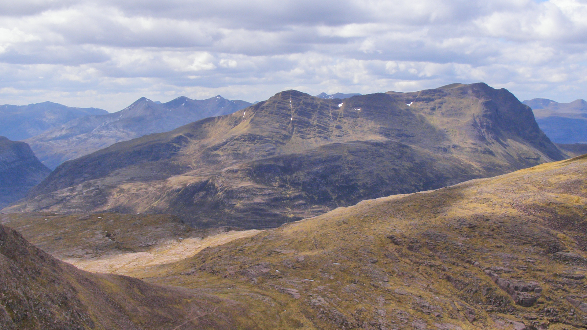
On Sgurr Dubh looking to Slioch
The route described above takes a sheltered way when westerly winds are blowing. However, a finer route traversing Sgurr Dubh is recommended on calm days which has the advantage of getting higher quicker and therefore gives the opportunity of enjoying views for longer.
Follow the route described above until the point before the bealach between Sgurr Dubh and Meall Each is reached, where the gradient of the path begins to ease .
Leave the path and strike directly uphill on rough terrain through heather and around some boulders. Gradient steepens higher up and a path begins to form. The path climbs up onto the summit of Sgurr Dubh  where views open up dramatically.
Now more obvious, the path traverses the wide crest of Sgurr Dubh to drop to the eastern of the two lochans below the final pull up to Slioch's summit plateau, where the route above is continued.
5. Sgurr an Tuill Bhain and return
")
On route to Sgurr an Tuill Bhain (© John King)
The most straightforward return is to about turn and retrace your steps back into Coire na Sleaghaich and down to Loch Maree.
Slioch has a minor 'Munro Top', Sgurr an Tuill Bhain, which is a short detour from its main summit and well worth the little extra effort needed.
To reach Sgurr an Tuill Bhain, from Slioch's northern summit, aim initially eastwards over easy ground. A crest forms which gradually narrows, but no difficulties are encountered.
Follow the crest, losing around 100m to drop to a col. Ahead is a short climb of 50m or so to the summit of Sgurr an Tuill Bhain  , where effort is rewarded with some fine views.
To return, head southwards from Sgurr an Tuill Bhain's summit, to pick up a faint path to drop down into Coire na Sleaghaich - there is some loose ground and scree on route to contend with !
Once in Coire na Sleaghaich most hikers will opt to rejoin the main path to retrace steps to Incheril.
")
Looking back from Sgurr an Tuill Bhain to Slioch (© John King)
 where a rough but decent path tracing the northern edge of the Abhainn an Fhasaigh is picked up. This path returns to the junction marked by the cairn from where footsteps are retraced across the bridge over the Abhainn an Fhasaigh to return to Incheril.
Looking back from Sgurr an Tuill Bhain to Slioch (© John King)
6. Slioch Hill Race

Heading up Sgurr Dubh
Highland Hill Runners organise many hill races and in 2008 they sought to organise one up Ben Wyvis. However due to the presence of rare plants, Nature Scot (then Scottish National Heritage) refused permission and Slioch was put forward instead. Slioch's landowner was for it, but the bridge over the Abhainn an Fhasaigh had to be replaced. Luckily Nature Scot came forward with some money and the Slioch Hill Race was born.
The race route follows the outline above, taking the options of the climb up Sgurr Dubh, the traverse of the crest to Sgurr an Tuill Bain and the faint trod following the northern bank of the Allt Coire na Sleaghaich to drop into Gleann Bianasdail.

Onwards from Sgurr Dubh to Slioch
Onwards from Sgurr Dubh to Slioch
Route profile »

Maps and GPX downloads »


|
Download GPX of route |
The map images above link to items on Amazon. A small commission is earned on any map purchased which helps fund the operating costs of this website.
Weather forecasts »
| Regional | MWIS - Northwest Highlands |
| Peak specific | Mountain Forecast.com Met Office YR.no |
| Seasonal | SAIS - Torridon Midge forecast |
Alternative and nearby routes »
Meall a' Ghiubhais and Ruadh-stac Beag | |

|
Some fine hillwalking with some challenging navigation and route selection to gain the summits of two rugged Corbett peaks behind Beinn Eighe in Torridon. Peaks : 2 Corbetts
Ascent : 1430m (4690ft) Distance : 18km (11m) Time : 6:55hr |
Beinn an Eoin and Baosbheinn | |

|
A fine track heads in from near Gairloch to the foot of Baosbheinn and Beinn an Eoin, from where a circular hiking route over long wide ridges gains superb vantage points for stunning views of Torridon and the north-west coast. Peaks : 2 Corbetts
Ascent : 1575m (5170ft) Distance : 23km (14m) Time : 8:25hr |
Fisherfield Big 6 | |

|
The 5 Munros in Fisherfield, along with the Corbett Beinn a'Chlaidheimh (which used to be a Munro), are affectionately known as the 'Fisherfield Big 6'. Although most hikers backpack in and bag the peaks over two or three days, it is quite feasable to bag them in a day, particularly with the help of a bike on the track in. Peaks : 5 Munros, 1 Corbett, plus option of more !
Ascent : 2905m (9530ft) Distance : 44km (27m) Time : 12:15hr |


