

Black Mount mountains from Glen Etive
Hiking route up Beinn Mhic Chasgaig, Creise and Meall a' Bhuiridh
A there-and-back hillwalking route from Glen Etive up rough terrain to the Corbett peak Beinn Mhic Chasgaig and over to the Munros Creise and Meall a' Bhuiridh.
Route outline
| Munros | ||||
| Corbetts | ||||
| Ascent | 1500m (4920ft) | |||
| Distance | 15km (9m) | |||
| Time | 6:15hr | |||
| Start/finish | Alltchaoruinn, Glen Etive Grid Ref : NN198513 | |||
| Terrain |
| |||
| Nav |
| |||
| Effort |
| |||
| Scenery |
| |||


Beinn Mhic Chasgaig is a rugged little mountain near the northern entrance to Glen Etive, tucked behind the impressive rocky spurs of neighbouring Creise. Taken on its own, a hike up Beinn Mhic Chasgaig makes for a short outing, therefore extending the route to Creise and nearby Meall a' Bhuiridh makes for a longer and more enjoyable day.
The obvious approach is from the bridge over the River Etive by Alltchaorunn, from where a fine track begins beyond an intimidating gate. Higher up, paths are faint and crests are wide.
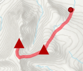
Show map
Route description
1. Getting to Alltchaoruinn in Glen Etive
On the A82, just south of Glencoe, there is a narrow road heading down Glen Etive. Drive down this of around 6km, where by the south side of the road there is a bridge over the River Etive with a private road leading up to a house. Park by here, there is limited verge parking.
2. Beinn Mhic Chasgaig

Beinn Mhic Chasgaig in front of Etive Mor from Stob Ghabhar
Cross the bridge, and you'll be presented with a very intimidating gate  with spikes around it. Through the gate and using a path, go around the house
  then follow the path on the east side of the Allt a'Chaorainn for 1km.
Just after where Allt a'Chaorainn and Allt Coire Ghlubhasan merge  , the path aims to cross the burn - don't cross, keep on the north side of the burn for another 300m or so, until past the crags above on your left.
Now head north-east and strike directly uphill and get onto Beinn Mhic Chasgaig's western shoulder. Once on the crest, gradient easies and the summit of Beinn Mhic Chasgaig  with its small lochans is reached.
3. Creise

On Criese's summit looking to Meall a' Bhuiridh
To continue to the Munros of Creise and Meall a'Bhuiridh, from Beinn Mhic Chasgaig's summit, head south-east down steep ground to a bealach  .
.
A slightly more gentle gradient heads up the other side of the bealach and although pathless, the route is pretty obvious picking a grassy route most of the way. Higher up the terrain is more stoney, indicating the broad bouldery plateau of Creise is approaching.
Once on the crest of Creise, look for a cairn around the middle of the plateau  - this indicates the route to Meall a'Bhuiridh. You should be able to pick up a path heading in a generally northwards direction through gravel and boulders. Stones give way to grass, with the path becoming more obvious as the last climb up to the summit of Creise
  is done.
4. Meall a' Bhuiridh

View over the Black Mount from Meall a' Bhuiridh
From Creise's summit, return 750m to the cairn you noted earlier on the way up. In winter the cornice may be substantial and technical winter gear may be required to proceed if icy !
Aim eastwards from this cairn and scramble down the initial blocks and steep ground. The route should be obvious with a path meandering a way down to the bealach below Meall a' Bhuiridh.
The path continues eastwards up a ridge and over stones and scree, with some of the route sticking to the crest and other times on either side. The untidy summit cairn of Meall a'Bhuiridh  is reached above the top of the ski-tows. A fine vantage point over the Black Mount to Rannoch Moor.
5. Return to Alltchaoruinn

Returning from Meall a' Bhuiridh to Creise
The easiest route for return is to head back along the ridge and up to the cairn on the plateau of Creise. Retrace your steps to the bealach below Beinn Mhic Chasgaig , then drop southwards to pick up the Allt Coire Ghlubhasan  to follow back to the house at Alltchaorunn.
Route profile »

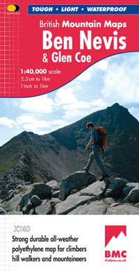
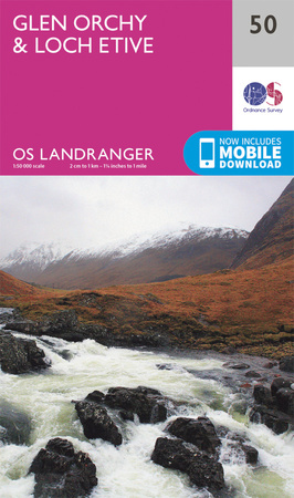
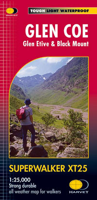
Maps and GPX downloads »


|
Download GPX of route |
Information on maps and GPX files is on this page.
The map images above link to items on Amazon. A small commission is earned on any map purchased which helps fund the operating costs of this website.
Weather forecasts »
| Regional | MWIS - Western Highlands |
| Peak specific | Mountain Forecast.com Met Office YR.no |
| Seasonal | SAIS - Glencoe Midge forecast |
Alternative and nearby routes »
Black Mount Munros Traverse | |

|
Linear hillwalking route from Victoria Bridge to Glencoe Ski Centre over Stob Ghabhar, Meall a' Bhuiridh and neighbouring Munros above the Black Mount. Peaks : 4 Munros
Ascent : 1950m (6400ft) Distance : 20km (12m) Time : 8:15hr |
Meall a' Bhuiridh and Creise | |
|
A there-and-back hillwalking route from Glencoe Ski Resort up Meall a' Bhuiridh and Creise, the two northern Munros of the Black Mount. Peaks : 2 Munros
Ascent : 1090m (3580ft) Distance : 10km (6m) Time : 4:20hr |
Shepherds of Etive | |

|
The rugged mountains and iconic peaks of Buachaille Etive Mor and Etive Beag guard the entrances to Glencoe. Long high-level ridges between Munro summits and some easy scrambing make for a classic hillwalking route. Peaks : 4 Munros
Ascent : 1875m (6150ft) Distance : 19km (12m) Time : 8hr |
Stob a' Choire Odhair and Stob Ghabhar | |

|
Circular hillwalking route from Victoria Bridge over Stob a' Choire Odhair and Stob Ghabhar in the Black Mount returning down aside some spectacular waterfalls. Peaks : 2 Munros
Ascent : 1250m (4100ft) Distance : 15km (9m) Time : 5:50hr |


